[Contents]
[Contents]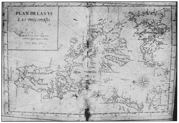
Map of the Philippine Islands (ca.1742)
[Photographic facsimile of original MS. map inMuseo-Biblioteca de Ultramar, Madrid]
[Contents]
The Philippine Islands, 1493–1898
Explorations by early navigators, descriptions ofthe islands and their peoples, their history and records of thecatholic missions, as related in contemporaneous books and manuscripts,showing the political, economic, commercial and religious conditions ofthose islands from their earliest relations with European nations tothe close of the nineteenth century,
Volume XLVII, 1728–1759
The Arthur H. Clark Company
Cleveland, Ohio
MCMVII
Cleveland, Ohio
MCMVII
[iii]
[Contents]
CONTENTS OF VOLUME XLVII
| Preface | 11 | |||||||
| Documents of 1728–1759 | ||||||||
| The Santa Misericordia of Manila. Juan Bautista deUriarte; Manila, 1728 | 23 | |||||||
| Survey of the Filipinas Islands. FernandoValdés Tamón; Manila, 1739. (To this is added, “Theecclesiastical estate in the aforesaid Philipinas islands,” byPablo Francisco Rodriguez de Berdozido; [Manila], 1742.) | 86 | |||||||
| The Order of St. John of God. Juan Maldonado dePuga ... BU KİTABI OKUMAK İÇİN ÜYE OLUN VEYA GİRİŞ YAPIN!Sitemize Üyelik ÜCRETSİZDİR! | ||||||||