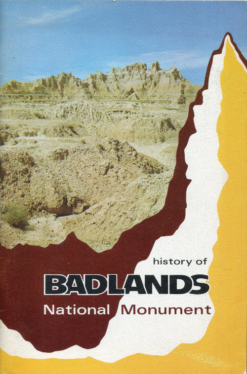
Cover Photo: THE CASTLE, five miles west of Cedar Pass and just west of NorbeckPass, is a spectacular saw-tooth ridge which was named by early local ranchers. Thespires rise more than 200 feet above the Fossil Exhibit Trail (see Figure 28) and approximately450 feet above the lower grassland plains which are out of view on the left.The ridge is an eroded remnant of rock layers which formerly covered Badlands NationalMonument and surrounding areas.
HISTORY
OF
BADLANDS NATIONAL MONUMENT
and
The White River (Big) Badlands of South Dakota
by
Ray H. Mattison
and
Robert A. Grom
edited by
Joanne W. Stockert
Bulletin No. 1
Published 1968 by the
Badlands Natural History Association
Badlands National Monument
Interior, South Dakota 57750
Printed at Rapid City, South Dakota, U.S.A.
By Espe Printing Company
First Edition
Library of Congress Catalog Number: 68-19055
This booklet is published by the Badlands Natural HistoryAssociation, a nonprofit corporation dedicated to assistingthe National Park Service in its scientific, educational, historical,and interpretive activities at Badlands NationalMonument. Organized in April 1959, the association isincorporated under the laws of the State of South Dakota.It is recognized by the National Park Service, United StatesDepartment of the Interior, as an official cooperating organization.A list of mail-sales items handled by theassociation may be obtained free by sending a card orletter to the address shown on the title page.
The Badlands Natural History Association wishes to thankthe many local people who have contributed their know-howand resources in making this publication possible.
CONTENTS
- Introduction 7
- Chronology of Badlands National Monument and the White River (Big) Badlands 9
- Early Indians and Explorers 11
- The Settlers Come 23
- Legislation for Park Establishment 27
- The Depression Years 37
- Early Development of the National Monument 43
- Mission 66 Development 59
- APPENDIX
- A Annual Visitor Use, 1938-1967 65
- B Custodians and Superintendents of Badlands National Monument 67
- C Picture Credits 69
- D Footnotes and References 71
- E Map of Badlands National Monument 79 ...